Class 7 Social Science Chapter 1 Worksheet Solutions - Geographical Diversity of India
| Table of contents |
|
| Multiple Choice Questions (MCQs) |
|
| Fill in the Blanks |
|
| Very Short Answer Questions |
|
| Short Answer Questions |
|
| Match the Following |
|

Multiple Choice Questions (MCQs)
Q1: What is the meaning of the word 'Himalaya' in Sanskrit?
a) Frozen peaks
b) Land of snowstorms
c) Abode of snow
d) Cold mountains
Ans: c) Abode of snow
'Himalaya' is derived from Sanskrit where 'Hima' means snow and 'Alaya' means abode or home.
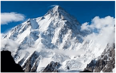 Himalayas
Q2: Which of the following is India’s only active volcano?
a) Mount Abu
b) Barren Island
c) Kanchenjunga
d) Deomali
Ans: b) Barren Island
Barren Island in the Andaman Sea is home to India’s only active volcano.
Q3: The Gangetic Plains are considered ideal for agriculture because of:
a) Rocky terrain
b) Mineral-rich soil from rivers
c) Frequent snowfall
d) Presence of deserts
Ans: b) Mineral-rich soil from rivers
Rivers like the Ganga bring mineral-rich soil from the Himalayas, making the plains very fertile.
Q4: Which desert festival is celebrated in the Thar region?
a) Diwali
b) Pushkar Mela
c) Losar
d) Pongal
Ans: b) Pushkar Mela
Pushkar Mela is a popular camel and cultural fair held in Rajasthan's Thar Desert region.
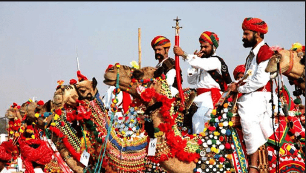 Pushkar Mela
Q5: Which river flows westward into the Arabian Sea instead of eastward into the Bay of Bengal?
a) Godavari
b) Krishna
c) Narmada
d) Kaveri
Ans: c) Narmada
Unlike most rivers, Narmada flows west into the Arabian Sea.
Q6: What kind of landform is the Peninsular Plateau?
a) Flat desert
b) High mountain
c) Elevated flat land with steep slopes
d) River valley
Ans: c) Elevated flat land with steep slopes
Plateaus are high flat areas with steep sides.
Q7: Which Indian region is called a cold desert?
a) Ladakh
b) Sundarbans
c) Sikkim
d) Arunachal Pradesh
Ans: a) Ladakh
Ladakh has extremely cold weather and very little rainfall, making it a cold desert.
Q8: Which Indian mountain range helps stop the spread of the Thar Desert?
a) Himalayas
b) Western Ghats
c) Vindhyas
d) Aravallis
Ans: d) Aravallis
The Aravalli range acts as a natural barrier to prevent the eastward spread of the Thar Desert.
Q9: Which plateau region is known for heavy rainfall and root bridges?
a) Deccan Plateau
b) Bundelkhand Plateau
c) Meghalaya Plateau
d) Malwa Plateau
Ans: c) Meghalaya Plateau
The Meghalaya Plateau experiences heavy rainfall and has famous living root bridges.
Q10: Which animal is important for transport and daily life in Ladakh?
a) Tiger
b) Yak
c) Camel
d) Elephant
Ans: b) Yak
Yaks are vital in Ladakh for transport, milk, wool, and dung.
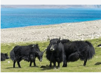 Yak at Ladakh
Fill in the Blanks
Q1: India is a part of the __________ Subcontinent.
Ans: Indian
India along with its neighboring countries forms the Indian Subcontinent.
Q2: The highest peaks of the Himalayas are located in the __________ Himalayas.
Ans: Himadri
Himadri or Greater Himalayas contain the tallest peaks like Mount Everest.
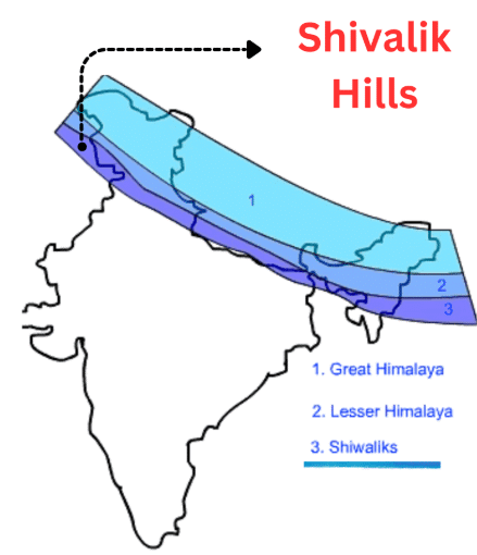
Q3: The outermost range of the Himalayas is called the __________ Hills.
Ans: Shivalik
The Shivalik Hills are the lowest and outermost part of the Himalayan range.
Q4: The Thar Desert covers states like Rajasthan and __________.
Ans: Gujarat
The Thar Desert spans across western India, including Gujarat.
Q5: Ladakh is also called the __________ desert of India.
Ans: Cold
Ladakh is a cold desert due to its icy weather and dry climate.
Q6: __________ and Tapti are the two major west-flowing rivers of India.
Ans: Narmada
Both Narmada and Tapti flow westwards into the Arabian Sea.
Q7: The peacock, India’s national bird, is found in the __________ Plains.
Ans: Gangetic
The fertile Gangetic Plains support rich wildlife including the peacock.
Q8: The Western Ghats are recognized as a __________ World Heritage Site.
Ans: UNESCO
The Western Ghats are a biodiversity hotspot declared by UNESCO.
Q9: The Sundarbans are known for their __________ forests.
Ans: Mangrove
Sundarbans are famous for mangrove trees growing in salty coastal areas.
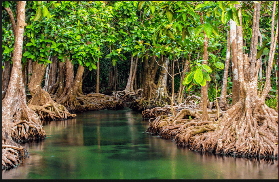 Mangroves
Q10: An __________ is a group or chain of islands.
Ans: Archipelago
Lakshadweep is an archipelago consisting of 36 coral islands.
Very Short Answer Questions
Q1: What is the approximate length of the Himalayas?
Ans: About 2,500 km.
Q2: Name the two island groups of India.
Ans: Lakshadweep and Andaman & Nicobar Islands.
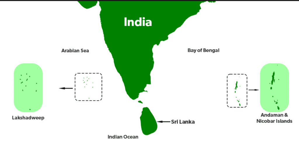 Islands of India
Q3: What is the cleanest village in Asia?
Ans: Mawlynnong in Meghalaya.
Q4: Which hill stations are found in the Himachal range?
Ans: Shimla, Manali, Dharamshala.
Q5: Which mineral is extracted in Zawar mines of the Aravallis?
Ans: Zinc.
Short Answer Questions
Q1: Why are the Himalayas called the ‘Water Tower of Asia’?
Ans: Because they store snow and glaciers which melt in summer and feed rivers like the Ganga, Brahmaputra, and Indus, providing water to millions of people.
Q2: What are some adaptations seen in the Thar Desert region?
Ans: People use camels for transport, clean utensils with sand, and harvest rainwater using tankas and kunds due to water scarcity.
Q3: Describe two features of the Peninsular Plateau.
Ans: It is a triangular plateau surrounded by water on three sides and is rich in minerals and forests, supporting agriculture and hydroelectric power.
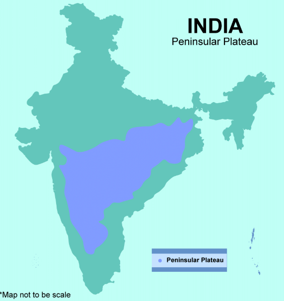 Peninsular Plateau
Q4: How are the islands of Andaman and Nicobar ecologically important?
Ans: They have coral reefs, tropical forests, unique wildlife, and are home to some of the oldest tribes in India, contributing to biodiversity.
Q5: What makes the Ganga and Brahmaputra rivers culturally special?
Ans: They are considered sacred in Indian culture and are personified as deities like Ganga and Brahmaputra, playing a role in rituals and beliefs.
Match the Following
(Match Column A with the correct option in Column B)
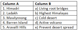
Ans: Matched Pairs and Explanations:
- 1 → b: Himadri is the highest Himalayan range with peaks over 8000 m.
- 2 → c: Ladakh is India’s cold desert with extreme winters.
- 3 → a: Mawlynnong is known for eco-tourism and root bridges.
- 4 → d: Barren Island hosts India’s only active volcano.
- 5 → e: The Aravallis block the expansion of the Thar Desert.
|
1 videos|107 docs
|
FAQs on Class 7 Social Science Chapter 1 Worksheet Solutions - Geographical Diversity of India
| 1. What are the major geographical features of India? |  |
| 2. How does geographical diversity affect the climate of India? | |
| 3. What role do rivers play in the geographical diversity of India? | |
| 4. How does India's topography influence its agriculture? | |
| 5. What is the significance of geographical diversity in India's culture and traditions? | |


Exam
,study material
,Free
,Extra Questions
,Important questions
,MCQs
,shortcuts and tricks
,mock tests for examination
,Objective type Questions
,Summary
,past year papers
,Viva Questions
,Previous Year Questions with Solutions
,practice quizzes
,Class 7 Social Science Chapter 1 Worksheet Solutions - Geographical Diversity of India
,Sample Paper
,Semester Notes
,video lectures
,Class 7 Social Science Chapter 1 Worksheet Solutions - Geographical Diversity of India
,Class 7 Social Science Chapter 1 Worksheet Solutions - Geographical Diversity of India
,ppt
;


Worksheet Solutions: Geographical Diversity of India Free PDF Download
Importance of Worksheet Solutions: Geographical Diversity of India
Worksheet Solutions: Geographical Diversity of India Notes
Worksheet Solutions: Geographical Diversity of India Class 7 Questions
Study Worksheet Solutions: Geographical Diversity of India on the App
|
© EduRev
|
Education Revolution
|


|


